New methods of acquiring spatial data and the advent of geographic information systems (GIS) for handling and manipulating data mean that we no longer must rely on paper maps from a single source, but can acquire, combine, and customize spatial data as needed. To ensure quality results, however, one must fully understand the diverse coordinate frameworks upon which the data are based. Datums and Map Projections provides clear, accessible explanations of the terminology, relationships, transformations, and computations ...
Read More
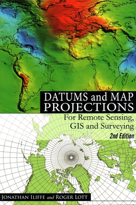
New methods of acquiring spatial data and the advent of geographic information systems (GIS) for handling and manipulating data mean that we no longer must rely on paper maps from a single source, but can acquire, combine, and customize spatial data as needed. To ensure quality results, however, one must fully understand the diverse coordinate frameworks upon which the data are based. Datums and Map Projections provides clear, accessible explanations of the terminology, relationships, transformations, and computations involved in combining data from different sources. The first half of the book focuses on datums, exploring different coordinate systems and datums, including two- and three-dimensional representations of Earth coordinates and vertical datums. After an overview of the global positioning system (GPS), the author introduces the fundamentals of map projections and examines the different types. He then presents models and procedures for transforming directly between data sets. The final chapter presents case studies of projects that illustrate the types of problems often encountered in practice. Newcomers to the field will welcome this treatment that, instead of detailed mathematics, uses lucid explanations and numerous examples to unravel the complexities of the subject. For more experienced readers, the book is a valuable reference that answers specific questions and imparts a better understanding of transformation operations and principles. Features
Read Less
Add this copy of Datums and Map Projections for Remote Sensing, GIS and to cart. $57.37, new condition, Sold by GreatBookPricesUK5 rated 4.0 out of 5 stars, ships from Castle Donington, DERBYSHIRE, UNITED KINGDOM, published 2008 by Whittles.
Choose your shipping method in Checkout. Costs may vary based on destination.
Seller's Description:
New. Trade paperback (US). Glued binding. 224 p. Contains: Illustrations. In Stock. 100% Money Back Guarantee. Brand New, Perfect Condition, allow 4-14 business days for standard shipping. To Alaska, Hawaii, U.S. protectorate, P.O. box, and APO/FPO addresses allow 4-28 business days for Standard shipping. No expedited shipping. All orders placed with expedited shipping will be cancelled. Over 3, 000, 000 happy customers.
Add this copy of Datums and Map Projections to cart. $57.38, new condition, Sold by Books2anywhere rated 5.0 out of 5 stars, ships from Fairford, GLOUCESTERSHIRE, UNITED KINGDOM, published 2008 by Whittles Publishing.
Choose your shipping method in Checkout. Costs may vary based on destination.
Seller's Description:
PLEASE NOTE, WE DO NOT SHIP TO DENMARK. New Book. Shipped from UK in 4 to 14 days. Established seller since 2000. Please note we cannot offer an expedited shipping service from the UK.
Add this copy of Datums and Map Projections for Remote Sensing, GIS and to cart. $59.16, new condition, Sold by Ria Christie Books rated 4.0 out of 5 stars, ships from Uxbridge, MIDDLESEX, UNITED KINGDOM, published 2008 by Whittles.
Add this copy of Datums and Map Projections to cart. $60.97, new condition, Sold by Paperbackshop International rated 1.0 out of 5 stars, ships from Fairford, GLOS, UNITED KINGDOM, published 2008 by Whittles Publishing.
Choose your shipping method in Checkout. Costs may vary based on destination.
Seller's Description:
PLEASE NOTE, WE DO NOT SHIP TO DENMARK. New Book. Shipped from UK in 4 to 14 days. Established seller since 2000. Please note we cannot offer an expedited shipping service from the UK.
Add this copy of Datums and Map Projections for Remote Sensing, GIS and to cart. $65.41, new condition, Sold by Booksplease rated 4.0 out of 5 stars, ships from Southport, MERSEYSIDE, UNITED KINGDOM, published 2008 by Whittles.
Add this copy of Datums and Map Projections to cart. $70.81, new condition, Sold by Kennys.ie rated 4.0 out of 5 stars, ships from Galway, IRELAND, published 2008 by Whittles.
Add this copy of Datums and Map Projections: for Remote Sensing, Gis and to cart. $80.16, new condition, Sold by Bonita rated 4.0 out of 5 stars, ships from Santa Clarita, CA, UNITED STATES, published 2000 by Whittles Publishing.
Add this copy of Datums and Map Projections: for Remote Sensing, Gis and to cart. $212.47, new condition, Sold by Bonita rated 4.0 out of 5 stars, ships from Santa Clarita, CA, UNITED STATES, published 2008 by Whittles Publishing.