-
Recommended Copy
-
Recommended Copy
-
-
-
-
-
-


Additional copies that match your search:

-
1. International Code of Signals
by Defense Mapping Agency, Hydrographic Topographic Center

Seller Description: Fine. Tight binding. No spine or hinge creases. No markings or dog-ears. 156 p. Includes: illustrations, diagrams, maps. Hardcover. Black cloth on board. Includes color plate, appendices, indices. Photos available on request. "As adopted by the Fouirth Assembly of the Inter-Governmental Maritime Consultative Organization in 1965" "For Visual, Sound, and Radio Communications" "United States Edition, 1969 (Revised 1981)" See More Details
1981, Defense Mapping Agency
Hardcover, Fine/Like New
Boone, IA, USA
£11.32
-
2. Defense Mapping Agency Catalog of Maps, Charts, and Related Products: Part 2-Volume 1, Hydrographic Products, Nautical Charts and Publications
by Defense Mapping Agency/Department Of Defense
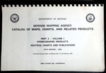
Seller Description: Good. Comb-bound Paperback. Good. General used condition. Evident wear. Text block clean and unmarked. See More Details
1994, Defense Mapping Agency/Department of Defense
Paperback, Good
Spring Branch, TX, USA
£21.38
-
3. Handbook of Magnetic Compass Adjustment Pub. No. 226
by Agency, Defense Mapping; Center, Hydrographic/Topographic; Spencer, Nye S.; Kucera, George F.
Seller Description: Hardcover 4th Edition (1980) in Very Good+ or Near Fine condition without a dust jacket. The covers are in great shape. Small abrasion to the front flyleaf. The interior pages are clean and unmarked. The book will be carefully packaged for shipment for protection from the elements. USPS electronic tracking number issued free of charge. 96 pages. See More Details
1980, Defense Mapping Agency
ISBN-13: 9781114810822
Hardcover, Very Good
BALTIMORE, MD, USA
£21.42
-
4. Catalog of Nautical Charts: Miscellaneous and Special Purpose Navigational Charts, Sheets, and Tables
by Defense Mapping Agency Hydrographic Center
Seller Description: Very Good. Very Good condition. 4th edition. (Nautical charts, navigation, maps) See More Details
Wonder Book - Member ABAA/ILAB
Frederick, MD, USA
£22.51
-
5. Pub No. 229 Vol 3: Sight Reduction Tables for Marine Navigation Latitudes 30-45, Inclusive
by Defense Mapping Agency
Seller Description: Good. Hardcover. No DJ. Pages with only a couple underlines. Covers show light edge wear with rubbing. Binding is tight, hinges strong.; 100% Satisfaction Guaranteed! Ships same or next business day! See More Details
1970, U. S. Government Printing Office
Hardcover, Good
Wyoming, MI, USA
£23.40
-
6. Tactical Pilotage Chart TPC G-7D China, India, Pakistan (1: 500, 000)
by Defense Mapping Agency Aerospace Center

Seller Description: Very good. No dust jacket. 1 p. Includes maps. St. Louis, Missouri: Defense Mapping Agency Aerospace Center, compiled November 1967, revised March 1995. Map. TPC G-7D China; India; Pakistan [Not for navigational use]. See More Details
1995, Defense Mapping Agency Aerospace Center
Arlington, VA, USA
£24.23
-
7. Sailing Directions (Enroute): Pacific Islands. 5th Ed
by Defense Mapping Agency
Seller Description: Very Good. Large paperback in very good condition. 5th edition. See More Details
1996, Defense Mapping Agency
Softcover, Very Good
Vancouver, WA, USA
£26.77
-
8. French Guiana Official Standard Names Gazetteer
by (French Guiana) Defense Mapping Agency
Seller Description: Washington 1974 Defense Mapping Agency. Oblong 4to., 62pp., original decorated wraps. Light non-circulating library marks, no spine numbers, no pocket, no bookplate. VG. See More Details
Paperback, Very Good
Glen Head, NY, USA
£42.05
-
9. Proceedings of the Third International Geodetic Symposium on Satellite Doppler Positioning. Volume 1 and 2, 1982, Volume 1 & 2: 1336 Pages With Illustrations
by Defense Mapping Agency And National Ocean Survey
Seller Description: Good. Physical Science Laboratory of the New Mexico State University, 1982. 2 volume set. 4to Hardcover. 656pp; pp657-1336. B/W and color photos, graphs and maps. Good set. Slightly dampstained. Stamped on page edges and front endpage. (doppler navigation, artificial satellites, technology) Inquire if you need further information. NOT AVAILABLE FOR SHIPMENT OUTSIDE OF THE UNITED STATES. See More Details
Hardcover, Good
Wonder Book - Member ABAA/ILAB
Frederick, MD, USA
£48.85
-
10. Sight Reduction Tables for Marine Navigation Latitudes 15-30, Inclusive Vol. 2 Pub. No. 229
by Defense Mapping Agency Hydrographic Center
Seller Description: Good. Connecting readers with great books since 1972! Used textbooks may not include companion materials such as access codes, etc. May have some wear or writing/highlighting. We ship orders daily and Customer Service is our top priority! See More Details
1975, Defense Mapping Agency Hydrograp
hardcover, Good
Dallas, TX, USA
£50.95
-
11. American Practical Navigator: an Epitome of Navigation. 1981 Volume 2
by Bowditch, Nathaniel; Defense Mapping Agency Hydrographic/Topographic Center
Seller Description: Note: Volume 2 only. 961 pp. Glossary, abbreviations, index. Fine hardcover in green cloth boards (binding square and tight, no markings) / No dust jacket as issued. A clean, fresh copy. See More Details
1981, Defense Mapping Agency
Hardcover, Fine/Like New
Stow, OH, USA
£66.30
-
12. British Solomon Islands and Gilbert and Ellice Islands Official Standard Names Gazetteer
by (British Solomon Islands And Gilbert And Ellice Islands) Defense Mapping Agency
Seller Description: Washington 1974 Defense Mapping Agency. Oblong 4to., 202pp., original decorated wraps. Light non-circulating library marks, no spine numbers, no pocket, no bookplate. Near Fine. See More Details
Paperback, Very Good
Glen Head, NY, USA
£70.34
-
13. Cambodia-Official Standard Names Gazetteer-Second Edition
by (Cambodia) Defense Mapping Agency
Seller Description: Washington 1971 Defense Mapping Agency. Oblong 4to., 392pp., original illustrated wraps. Light non-circulating library marks, no spine numbers, no pocket, no bookplate. VG. See More Details
Paperback, Very Good
Glen Head, NY, USA
£82.47
-
14. South Korea Official Standard Names Gazetteer No. 95
by (South Korea) Defense Mapping Agency
Seller Description: Washington 1965 Defense Mapping Agency. Oblong 4to., 370pp., original illustrated wraps. Light non-circulating library marks, no spine numbers, no pocket, no bookplate. VG. See More Details
Paperback, Very Good
Glen Head, NY, USA
£82.47
-
15. Algeria Official Standard Names Gazetteer
by (Algeria) Defense Mapping Agency
Seller Description: Washington 1972 Defense Mapping Agency. 4to., 754pp., original decorated wraps. Light non-circulating library marks, no spine numbers, no pocket, no bookplate. VG. See More Details
Paperback, Very Good
Glen Head, NY, USA
£86.51
-
16. Antarctica Official Standard Names Gazetteer No. 14-3 Third Edition
by (Antarctica) Defense Mapping Agency
Seller Description: Washington 1969 Defense Mapping Agency. Oblong 4to., 923pp., original illustrated wraps. Light non-circulating library marks, no spine numbers, no pocket, no bookplate. VG. See More Details
Paperback, Very Good
Glen Head, NY, USA
£98.64